2008 Telegraph Fire
Our Personal (and Unforgettable) Experience
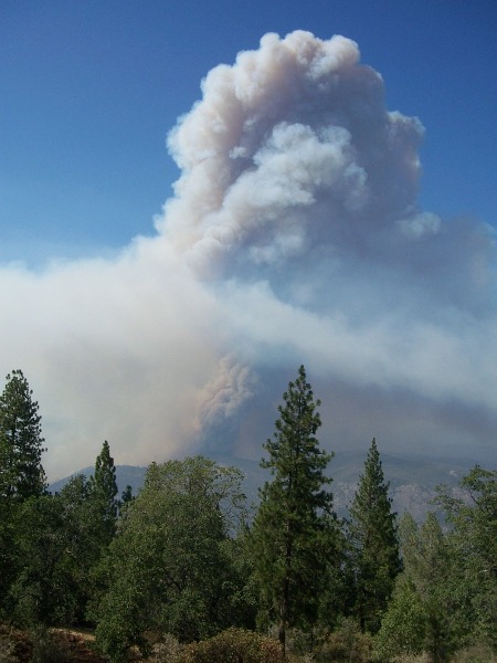
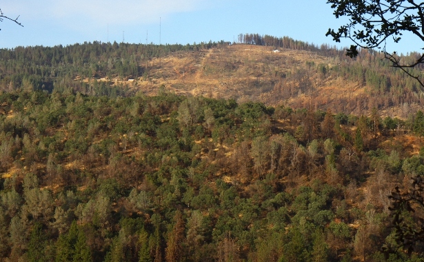
The Telegraph Fire started on Friday 25 July 2008 at 3:10 p.m. Because we can see Telegraph Hill from our property, we had a front-row view of the fire that afternoon. The picture below is from a neighbor's home.
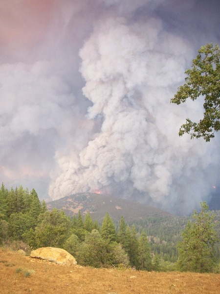
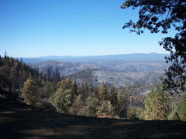
The fire looked under control Friday night, but began to flare up again Saturday morning. By 2:00 we became concerned and started packing some essentials into our cars. The shot below was taken about 4:15 when the fire crested Potato Hill about a mile away, where we hoped CalFIRE would establish a line of defense. Later we learned that the fire expanded by 16,000 acres (25 square miles) in just four hours that fateful day.
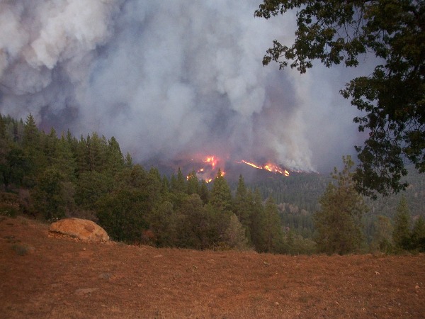
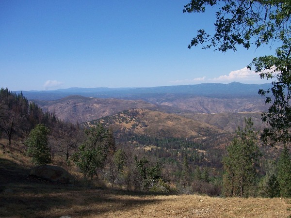
But the fire soon spotted in the canyon below us, and we knew it would immediately start coming up Mount Bullion toward our home. The shot below is the last one we took before evacuating. We met two fire captains in a pickup truck on our way out. They went to our property as we were assisting a neighbor, then promptly returned yelling, "Get out NOW!" It was just before 5:00 and the fire was already burning through our property. As we drove out the three miles of gravel road both of us, given the severity of the fire, thought we were certain to lose the piece of paradise we had built over the past 18 years.
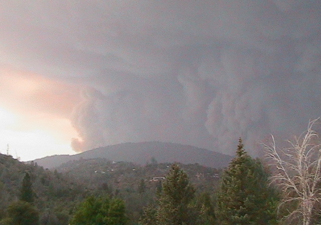
Below is a picture (taken by someone else) of Mount Bullion shortly after we evacuated. Our property is located over the ridge to the right, roughly where the pine tree in the foreground intersects the ridge line. We met no fire crews on our way out, and saw no planes or helicopters in the air at this time, so we knew our home was defenseless—and probably burning as we looked at this enormous cloud of smoke.
Our dear friends, the Mennig's, welcomed us to stay in their home in town. As comfortable as the accommodations were, neither of us could sleep that first night. We talked about what else we should have grabbed before we left and what we might do without a home. We spent Sunday worrying and crying, watching the fire continue to burn on Mount Bullion, and trying to regain our bearings. Then at 4:30 I called our neighbor Frank who had planned to stay and fight the fire. He did. And he was able to tell us, "You're fine." I asked what he meant by "fine" and he said, "Everything's still there; nothing burned." You can imagine our relief. We also learned, however, that our next-door neighbors and good friends, John & Wendy Vittands, suffered a total loss of their house, guesthouse and stables. Their four horses survived thanks to the heroic rescue by Jon Currie, who also lost his home below us on Whitlock Road.
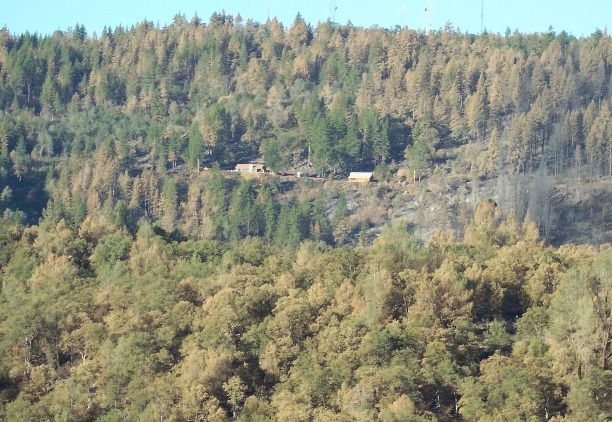
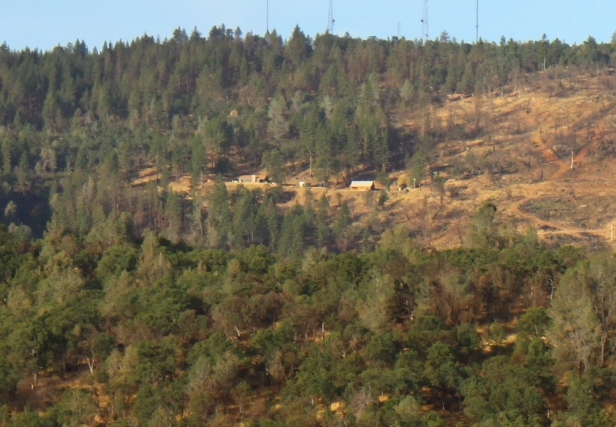
The pictures below were taken from the exact same spot as the last one we took before evacuating above. The first one is after we returned home; the second one is exactly one year later, and shows how much the view has changed after salvage logging of the dead trees. Note the column of smoke to the left in the second picture; it's from the Knight Fire 50 miles away that started a half-hour earlier. Note also the different lighting in this series of pictures. The one above (that we took just before evacuating) shows the sunlight filtered through the dense smoke that day. The first one below shows the shade from the pine trees that would be removed during salvage logging operations. The second shot below shows the additional sunlight we now get late in the afternoons.
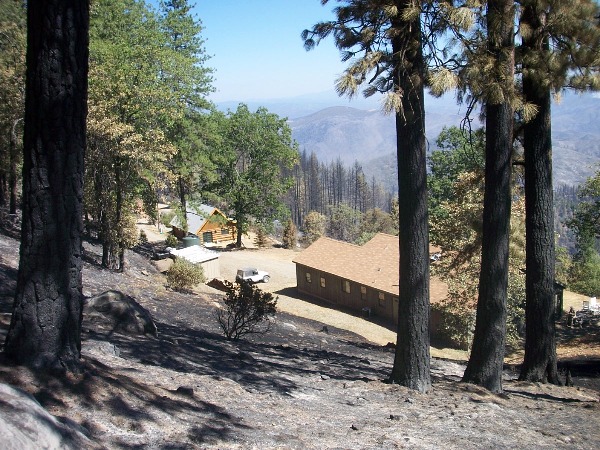
Here is a shot from further up the hill showing our house, cabin and shed—all intact with absolutely no damage whatsoever! Telegraph Hill, where the fire started, can be seen here above the charred pine trees; Potato Hill is obscured by the oak and three pine trees to the right. The firewood pile behind the Jeep also survived, as did our well and the water tank near where I took this picture. .
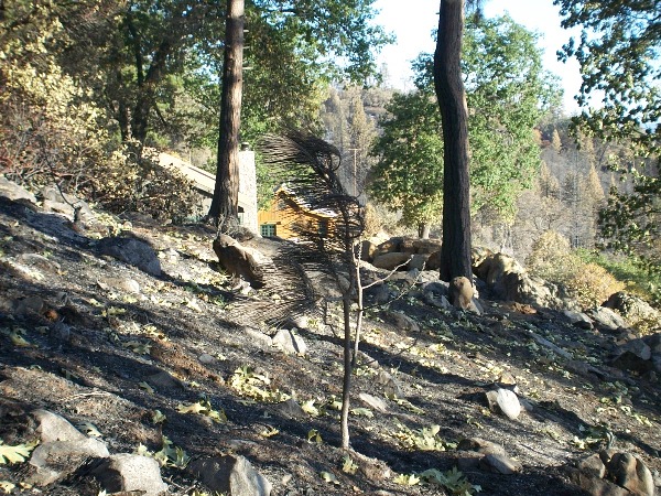
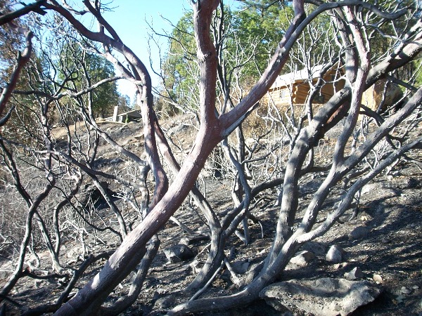
This shot was taken from further down the hill. Note how the strong wind created by the fire bent the needles on the pine sapling in the foreground.
This shot was taken from below the cabin through a charred Manzanita bush. The fire burned all around.
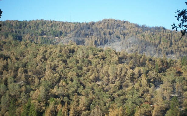
Here is a picture from across the canyon showing the "scorched earth" around our home. The fire burned quite hot on the right side, but also burned throughout the entire area (as evidenced by the brown needles on nearly all of the pine trees).
Here is a picture exactly one year later, again from across the canyon, showing the aftermath of the salvage logging operations.
These two shots show our mountainside (including neighboring properties) from across the canyon. The first was taken 10 days after the fire, revealing the extent of the damage; the second was taken exactly one year later and shows the aftermath of the salvage logging operations.
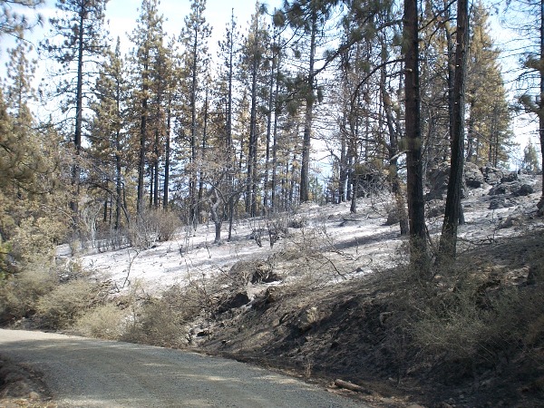
What appears to be snow on the ground in this picture is ash. In fact, many of the "after" pictures we took even appear to be black & white with all the charring and ash.
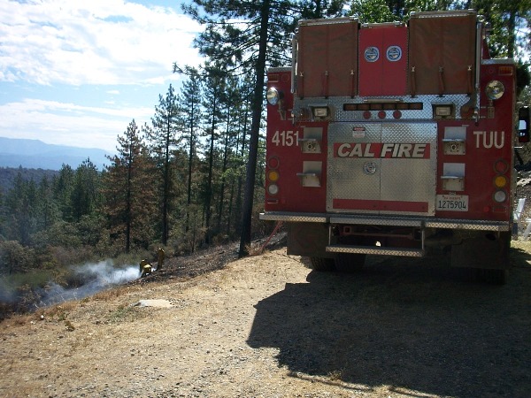
We were finally able to move back in after a full week as evacuees. The electrical transmission line crossing our property to power the towers at the top of Mount Bullion suffered severe damage, with many poles completely burnt and the lines lying on the ground. Many of the junction boxes where underground phone lines are spliced together were also damaged. The fire continued to smolder for another week after our return. Here's a shot of a crew putting out what they call a "smoke" in front of the house eleven days after the fire burned through the property.
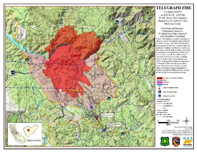
Here's a copy of the first CalFIRE report issued for the Telegraph Fire on Sunday 27 July 2008 showing that 26,130 acres (over 40 square miles) burned in the first two days. Note the yellow "X" marking our property (RedBuck) at the southern tip of the fire. Download the Final Telegraph Fire Incident Fact Sheet to see a summary report of the fire.
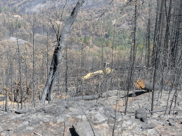
Salvage logging operations commenced in September. Shown here is an excavator (downhill from the driveway) with a log grapple stacking logs for later skidding to a landing site for loading the trucks.
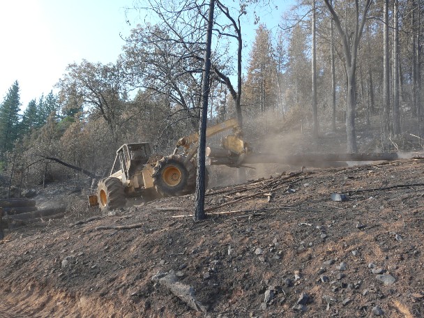
Here is the skidder hauling two more logs to the landing site.
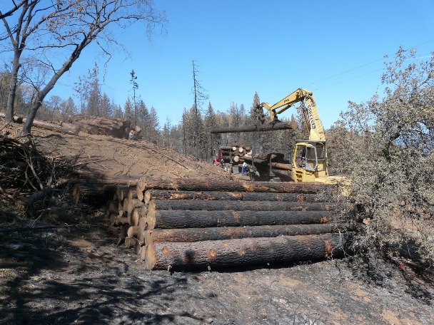
And here's the excavator loading some logs onto a truck for delivery to a mill, which will cut the logs into lumber. We estimate that some 50 truck-loads of trees were removed from our property alone.
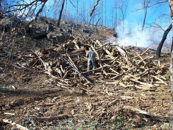
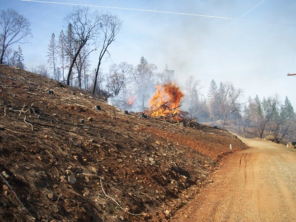
Salvage logging operations left a considerable amount of debris behind consisting of limbs and tree tops (that are too small for milling into lumber). Here's Roger lighting one such pile that is to the left in the picture above. In total, there were 105 burn piles(!), including those from brush and small trees that died in the fire. It seems ironic to need to burn so much after a fire, but the damage was quite extensive.
The pile burning belowis the size of a small house. Note how the heat from it ignited a stump (smoldering) about 50 feet up the hill. Note also the fire in the background to the left of this one.
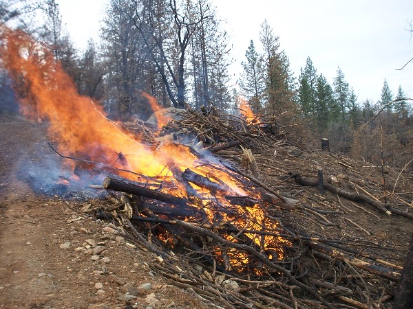
Here are three separate burn piles of debris near another landing site. There were a total of 24 debris piles from salvage logging operations, and Roger burned 23 of them in one day!
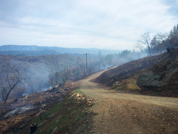
Here's a view looking the other way from the photo above showing what used to be a dense pine forest, and is now just ash and smoke.
If you live in a wooded area, please be sure you have "defensible" space around your property. We had what we now call "self-defensible" space—and we are very glad we did!
Also be sure to see the "Before and After" shots with side-by-side views from different vantage points.
Return to the RedBuck Retreat Main Page